
Here you’ll find a map with pollitical divisions of the United States, available for free download and printing.
This PDF-format map is an educational tool designed for students, teachers, and anyone interested in learning more about the country’s geography.
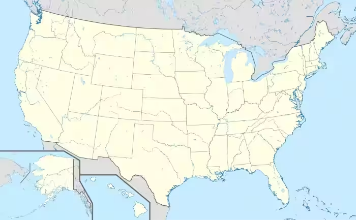
The map shows international borders as well as state boundaries. It includes rivers, but does not label counties or major cities. Alaska and the Hawaiian Islands are also included.
There are two download options available: A4 and Letter sizes. The layout is suitable for both formats and can be used in the classroom or at home—for school assignments or personal projects.
The United States is located in North America, between the Atlantic and Pacific Oceans. It borders Canada to the north and Mexico to the south, and also shares maritime boundaries with several countries in the Caribbean and the Pacific. The country covers an area of approximately 9.83 million square kilometers, making it one of the largest nations in the world by land area.
The United States has an extensive river system that has played a crucial role in its economic and territorial development. The most important rivers include the Mississippi River, the longest river system in the country, along with the Missouri, Ohio, Colorado, and Columbia rivers. These waterways are essential for transportation, agriculture, hydroelectric power, and water management across large regions.
The geography of the United States is extremely diverse, featuring mountain ranges, vast plains, deserts, forests, and long coastlines. Major geographic features include the Rocky Mountains in the west, the Appalachian Mountains in the east, the Great Plains in the central region, and deserts in the southwest. The country spans multiple climate zones, from arctic conditions in Alaska to tropical climates in Hawaii and southern Florida.
Administratively, the United States is divided into 50 states and the District of Columbia, which serves as the federal capital. It also includes several territories with varying degrees of self-government. The country has a population of approximately 335 million people, making it one of the most populous nations globally, with large concentrations in major metropolitan areas such as New York, Los Angeles, and Chicago.

Map of the United States
USA state maps
- Alabama map
- Alaska map
- Arizona map
- Arkansas map
- California map
- Colorado map
- Connecticut map
- Delaware map
- Florida map
- Georgia map
- Hawaii map
- Idaho map
- Illinois map
- Indiana map
- Iowa map
- Kansas map
- Kentucky map
- Louisiana map
- Maine map
- Maryland map
- Massachusetts map
- Michigan map
- Minnesota
- Mississippi map
- Missouri map
- Montana map
- Nebraska map
- Nevada map
- New Jersey map
- New Hampshire map
- New Mexico map
- New York map
- North Carolina map
- North Dakota map
- Ohio map
- Oklahoma map
- Oregon map
- Pennsylvania map
- Rhode Island map
- South Carolina map
- South Dakota map
- Tennessee map
- Texas map
- Utah map
- Vermont map
- Virginia map
- Washington map
- West Virginia map
- Wisconsin map
- Wyoming map
Find more content on Mentes Liberadas
That’s all for this article. I hope you enjoyed it.
You can make a donation to Mentes Liberadas through our Ko-Fi account. This way, you’ll be supporting the site, helping us create more content, resources, and online tools.
Thank you for taking the time to read.
See you in the next article on Mentes Liberadas.